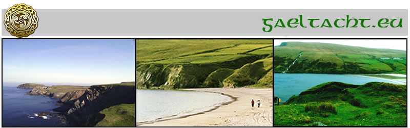
Walking in Dún Caocháin
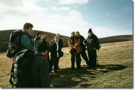
There is a variety of recommended walks to suit all age groups and abilities.
Wherever you go, remember to follow the Country Code.
-
Enjoy the countryside and respect its life and work.
-
Guard against all risk of fire.
-
Leave gates as you find them.
-
Keep dogs under close control.
-
Keep to paths across farmland.
-
Do not damage fences, hedges or walls.
-
Take your litter home.
-
Protect wildlife, plants and trees.
-
Take care on country roads.
-
Help to safeguard water supplies.
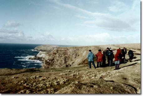
N.B. Observe caution when walking on cliffs and keep a safe distance from
the cliff edge.
Frigg spinning the Clouds
Artist unknown
Recommended Walking Gear
Wear suitable footwear, preferably walking boots. Also wear suitable clothing
such as waterproofs. It is always advisable to take along extra clothing,
as even on sunny days, sea breezes can be cool. A nutritious packed lunch
is essential to supply energy.
Walkers use these routes entirely at their own risk. No responsibility can
be accepted by landowners or by the publishers of this brochure, for any injuries
or damage incurred during walks.
The Portacloy (Port A' Chlóidh) Loop - Cliff Walk Trail Directions
Leaving Portacloy Beach follow the road to the left which runs parallel
to the bay for approx. 250 m. This takes you onto open commonage. Follow the
coastline as far as (ETeachín a' Watch) a former look out post.
Nearby the word EIRE 63 is marked on the ground in quartz stone i.e. the
number of the station. From here follow the line of the cliff passing An Dúna,
the remains of a promontory fort. The Stags of Broadhaven can be seen approx.
2 miles off the coast. Continue on to Benwee Head which, at 255 m above sea
level, is the highest point in the area. It is worth pausing here to take
in your surroundings. On a relatively clear day you can view the Mullet Peninsula
and Achill Island to the west and the Hills of Donegal to the north east.
Continue onwards to the Príosúin a wide inlet. Further west off the coast
Kid Island is visible. Follow the cliff south to Tóin Rinn na n-Éan and from
here proceed eastwards to Rinroe Peninsula. Turn right onto the road, which
takes you south to Rinroe Point There was a coastguard station and boathouse
here which were built around 1838.
Return north via the same route. At the landward end of the peninsula you
will notice a track to your right. Follow this track to the graveyard which
is worth a visit. On leaving the graveyard turn left and continue straight
ahead to the v-junction at the top of the hill. Keep to your right and continue
on passing the knitting factory and the old school on your left. 200 m further
on take the track to your left which crosses a stream. At the end of the track
turn right and continue north eastwards across the open commonage for 1.5
km. crossing another stream called "Abhainn na Sí Ruaidhe" ie. River of The
Red Fairy en route. Continue on to the bog road, turn right and follow the
road directly back to Portacloy Beach. Time and distance are approximate Distance
- 18 km. Aggregate height - 255m. Time - 4 hrs. 40 min. Grade - Moderate
Points of Interest
Teachín a' Watch
This was built during World War 2 and served as a look-out post to monitor
warships off the cost. A telephone was installed to enable contact to be made
with the coastguards.
EIRE 63
This is visible from the air. Ireland ramained neutral during the war and
the pilots would be aware they were flying over Ireland at this point.
An Dúna
The remains of promontory forts are present on numerous headlands. Most
are now in ruin as is the case here, but were built and occupied between the
Iron Age (fifth century B.C.) and the Early Christian Period (seventh century
A.D.) As these sites were surrounded on three sides by water, they offered
a natural defence. A wall or high bank was constructed at the landward end.
The Stags of Broadhaven
These consist of five sea-stacks which are 1.6 billion years old. They are
composed mainly of schist. The rock formation here is similar to that of Scotch
Port on the Mullet Peninsula which was upheaved at the same time. They are
home to a great number and variety of seabirds.
Benwee Head
Rising up out of the blanket bog is the well jointed Dalradian quartzite
of Benwee Head It derives it's name from the yellow colour of the quartzite
and is known in Irish as 'Binn Bhuí' ie. Yellow Peak.
Graveyard
There is a large mound located in the graveyard, which according to local
tradition and folklore is the burial place of Saint Gallagán (a local saint).
A stone slab bearing a carving of a Maltese cross was found on top of the
mound which indicates it dates back to the Early Christian Period.
The Cornboy (Corrán Buí) Loop - Seashore Walk
Trail Directions
Starting out from the old schoolhouse at Ceathrú Thaidhg take the road southeast
towards the shop. On passing the shop turn right, and continue on to your
left until you reach the end of the tarred road. Numerous lazy beds can be
observed to your right, a reminder of bygone days when the potato was the
most important source of food. Also to your right you may notice several strips
of unenclosed cultivated land running down towards the sea in a south-west
direction. This is the rundale or open field system of agriculture which is
still practiced here. If you look north westwards towards the townlands of
Ceathrú na gCloch and Cill a¹ Ghallagáin you will observe the opposite ie.
strips of enclosed land where rundale holdings have given way to owner occupied
farms.
Turn left here and continue on to the top of Garter Hill 156 m high. This
offers a splendid view of the surrounding area. Note a huge monument composed
of white stone, laid out on the ground to the north west. This is the 'Caochán'
sculpture.
From here proceed south eastwards towards the old chapel and then south
west in the direction of the shoreline. Follow the shoreline to you right
for approx. 1 km. 200 m inland from the shore is an old settlement site.
Continue on following the shoreline until you reach a track. Turn right
, passing the graveyard and on to the road. Follow the road straight ahead
(noting Caochán's monument in closer proximity to your left) to the V-junction
at the top of the hill.
Turn right and continue on to the old schoolhouse. N.B. Garter Hill and
the surrounding area of sand dunes have "machair" status. This is an area
of level, stable, coastal dune grassland. Machairí are now of great scientific
interest and have been preserved where traditional farming practices have
continued. This habitat was first defined in Scotland: hence the name, and
is mainly confined to the west coast from Galway to Donegal.
Time and distance are approximate Distance - 9 km. Aggregate Height - 50m.
Time - 2 hrs. 10 min. Grade - Easy
Points of Interest
Lazybeds
These ancient cultivation ridges (dating back to the Famine and before ie.
pre 1845) were made with a spade. They derive their name from the fact that
the sod or soil beneath the ridge was not dug, rather sods were dug on both
sides of the ridge, thus forming a trench or furrow and then placed face down
on the ridge itself. The width of the ridge averages 5 ft. and the furrow
1.5 ft. The seed potatoes or oats were then sown in the ridges. They usually
run parallel to the ground's natural slope, as is the case here.
Rundale
This is common grazing land. In the absence of fences all livestock are
removed during the crop growing season. When the last of the crops have been
harvested, the animals are again allowed to roam over the whole area. Elsewhere
the Land Commission has been responsible for the decline of the Rundale system,
by dividing and re-allocating strips of land. This work was carried out particularly
between 1922 and 1935, and can be seen in the surrounding townlands.
The Old Chapel
This is marked on a map dating to 1812. It was originally thatched and later
roofed with corrugated iron. It had a wooden altar and no seating. In 1911
a gale blew away the roof, badly damaging the walls. Shortly thereafter a
new church was built in Greanaí which was opened in 1914.
Old Settlement Site
It is marked on the O.S. map of 1920. These structures were simple , round
thatched houses, built of dry stone and mud or wattle. Also present are middens,
containing a variety of shells. The presence of numerous lazy-beds here would
indicate that what today is an area of shifting sand dunes was once a fertile
location. It is thought the structures were evacuated in favour of a more
sheltered site further inland.
The Caochán Sculpture
A component in the Tír Sáile Sculpture Trail which extends along the north
coast of Mayo. It was constructed as part of a project to commemorate 5000
years of habitation in Mayo. Caochán was a local mythical figure.